
First off there are two types of plates. There are oceanic plates and continental plates. The oceanic plates are more dense that the continental plates and sink bellow the continental plates. All the plates on earth are moving at some velocity with relation to each other, causing them to move to and away from other plates. This creates three different types of boundaries, convergent (colliding), divergent (spreading apart), and transform (sliding plates) boundaries.
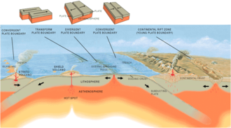 Divergent boundaries happen in the ocean (except for through Iceland) and are responsible for the oceanic ridges. Transform boundaries usually accompany divergent boundaries and often result in fractures cretingmany smaller divergent boundaries in a zig-zag pattern. Convergent boundaries are the most interesting and come in three flavors. Ocean-ocean boundaries, ocean-continental, and continental-continental boundaries. Each of these boundaries creates a buckling in the crust and is the main component of orogeny, which is the process of creating mountain regions. Most of the convergent boundaries are ocean-continental which is why most mountains are on the coast. The ocean-ocean boundaries create pockets of volcanic activity resulting in island chains. Then there are continental-continental boundaries which is responsible for creating the larges mountain ranges, such as the Himalayas because neither continental plate wants to sink bellow the other. I am taking a naive approach to plate tectonics in this generator and many of the topics are greatly simplified and fudged. If you are interested there are links on how it actually works here and on wikipedia.
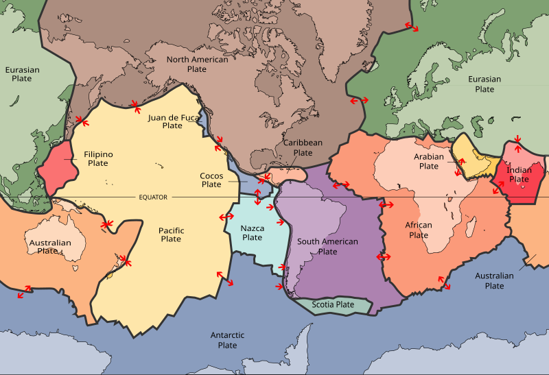
 So first, I started with the basic map generated with the noise function and then added the plates to the map. The plates were created with a relaxed voronoi diagram. The each plate is checked if it is an oceanic or continental plate depending on what kind of tile makes up the majority of the plate. The plate is then given a direction. From looking at maps of the movements of the plates, I saw that plates tend to move away from oceanic plates and try to move towards continental plates. This helps to orient oceanic plates to create convergent boundaries near the continents borders. Then you just need to calculate the boundary type based on the direction of the neighboring plates. This is shown bellow. The plate types are slightly colored green and blue respectively. The border types are calculated on the ratio from convergent to divergent. So the red lines are convergent boundaries and the divergent boundaries are the blue lines. Transform boundaries are green, and any boundary that is somewhat green is also partly a transform boundary.
 |
| Plate Boundaries - Convergent: Red, Divergent: Blue, Transform: Green |
Excellent, now that we have the plate boundaries we can figure out how to use them. The location of these plate boundaries is responsible for where the geologic provinces are. There are several types of geological provinces. The craton (which is a combination of the shield and platform provences) is a stable protions of the continent. The orogen is the location where orogenensis, or mountain building happens. Basins are flattened and depressed areas which are formed by erosion. Then there are the two oceanic provinces, the oceanic crust and the extended crust (continental shelf).

 |
| Blie: Ocean Crust, Pink: Craton, Green: Orogen, Merky Green-Blue: Basin |
And when we take away the plate borders we are left with the image at the bottom. I was happy with how it turned out so far. I think there is still some number tweaking that needs to be done. but the mountains are making long chains at the borders, and basins are where they should be. The next step is to add elevations to the land.

No comments:
Post a Comment